The Quoll Short Course option at Run Tasmania offers a thrilling taste of Tasmania’s wilderness for runners seeking a challenging yet more approachable adventure. While the distances are shorter than the long course, the Quoll still takes you across some of Tasmania’s best terrain — alpine ridges, lush rainforests, and dramatic sea cliffs — giving you all the beauty and variety of the island’s trails in a slightly smaller package. Over four rewarding days, you’ll experience the essence of Tasmanian trail running and forge a closer connection to its wild heart.
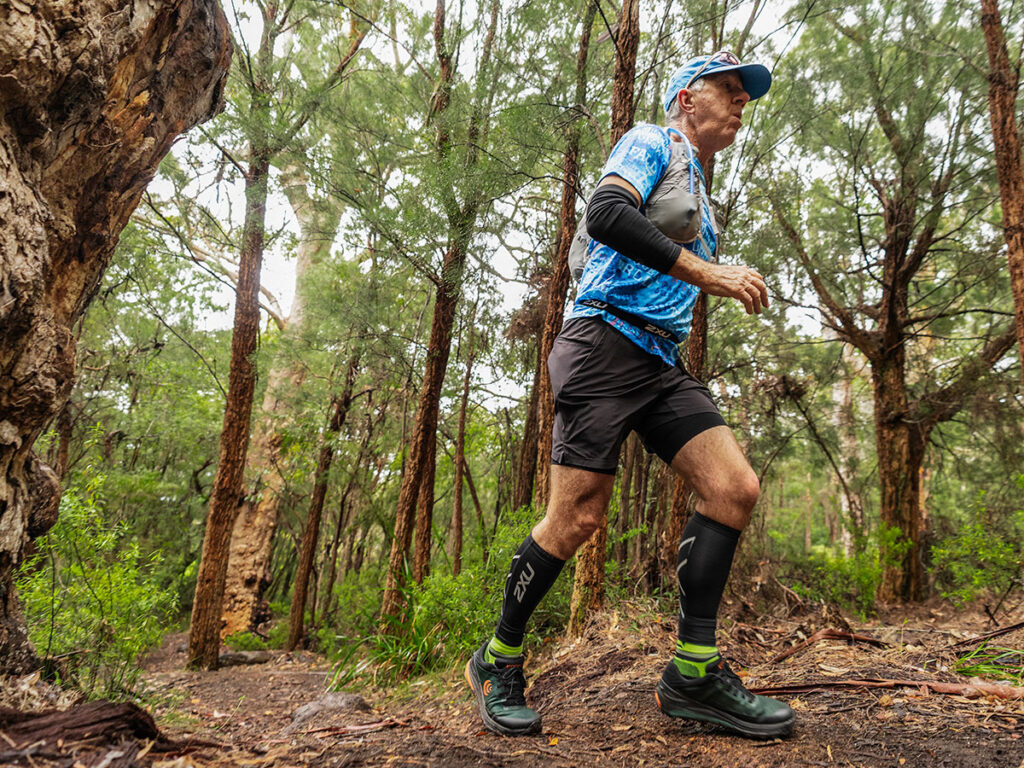
Despite the somewhat moderate distances, beware — Tassie’s trails are tough, rocky, and demanding. This is not a race for the faint of heart, but for the sure-footed and determined!
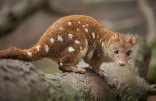
The Name: The Quoll is named after the Eastern Quoll – a native marsupial only found in Tasmania. Agile, curious, and tenacious, the Quoll perfectly captures the lively, adventurous spirit of this course.
Looking for the Devil Long Course Overview and Maps? Click Here >>
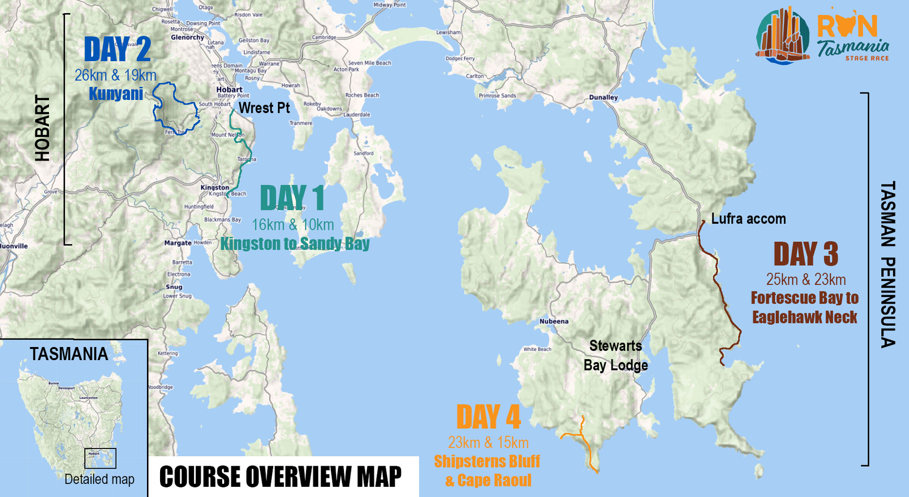
The Quoll Short Course – Overview
| DAY / DATE | LOCATION | STAGE |
| DAY 1: Wednesday 25 November | Kingston / Hobart | 10km + 430m ascent |
| DAY 2: Thursday 26 November | Kunanyi / Mount Wellington | 19km + 770m ascent |
| DAY 3: Friday 27 November | Fortescue Bay – Tasman Peninsula | 23.5km + 1020m ascent |
| DAY 4: Saturday 28 November | Cape Raoul – Tasman Peninsula | 15km + 785m ascent |
Overview Course Map
Quoll Course – Stage Descriptions
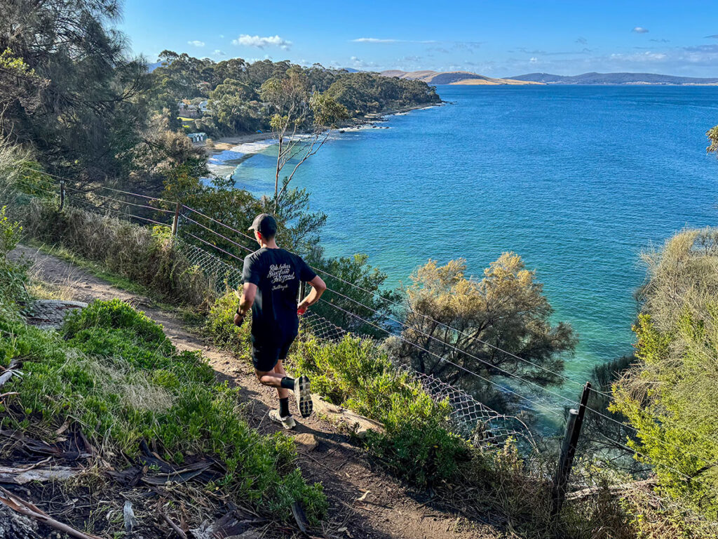
Day 1 – 10km – Taroona Coastline
- Start / Finish location: Taroona Beach to Sandy Bay
- Length and elevation gain: 10km with 430m ascent
- Terrain and landscape type: Generally flowing running on well used trails that weave between the suburbs and the coastline. Superb views over the Derwent River.
- Water Points: WP1 at 5.4km
- Difficulty rating: 4/10
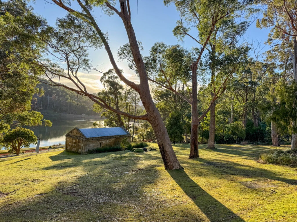
The Quoll Course begins on the sandy shores of Taroona before quickly becoming more technical as the route threads its way across rocky headlands and beaches of rounded river stones beside the water. A short stretch on suburban streets and parkland pathways provides a brief reprieve before the course turns inland and uphill at the 3.3km mark.
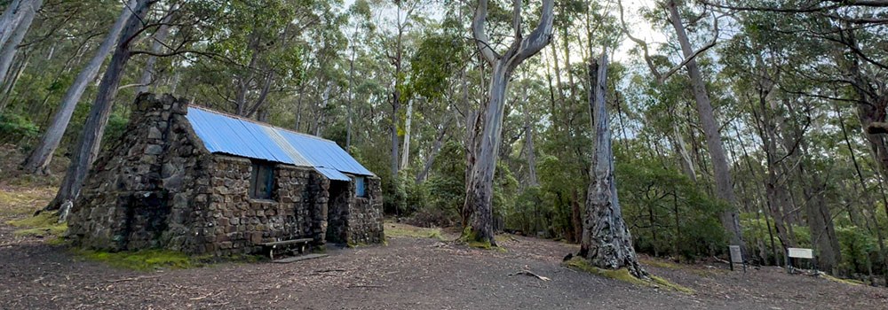
From here, runners face a solid climb up the Truganini Track to the Mount Nelson Signal Station — a rewarding ascent that offers sweeping views down the Derwent River to Opossum Bay and beyond. Then it’s time to open up the stride for a flowing, fast descent along the Lambert Rivulet, winding your way down to the finish line at Lower Queenborough Oval, Sandy Bay.
Stage 1 is the perfect warm-up for the days ahead — a compact mix of beach running, hills, and technical trails that showcase Tasmania’s wild beauty right on Hobart’s doorstep. A superb start.
Day 2 – 19km – Kunanyi Alpine
- Start / Finish location: The Springs to Waterworks Reserve, Hobart
- Length and elevation gain: 18.9km with 775m ascent and 1,300m descent
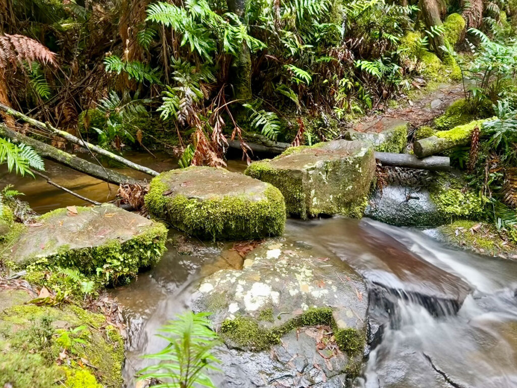
- Terrain type: Steep running on a range of technical trails, often rocky and sometimes slippery. Through fern lined gullies and over alpine summits.
- Water Points: WP1: 5.5km and WP2: 13km
- Difficulty rating: 8/10
Starting at a mid-mountain altitude of 695 metres at The Springs, the Quoll Course still packs a serious climb to the summit of Kunanyi / Mount Wellington at 1,280 metres. The stage begins with a steady traverse across the mountain’s flank, dipping through lush, fern-lined valleys and over rocky scree slopes before the trail turns upward at the 3.5km mark. From here, you will pass beneath the striking dolerite columns of the Organ Pipes and take on the legendary Zig Zag Track climb, before reaching the summit at the 9km point. Runners can enjoy a time-out-zone at the summit where your race time is paused so you can fully explore the boardwalks, take in the views and appreciate the spectacle!
From there, the course flows across two kilometres of superb summit skyline running — take a moment to soak in the panorama — before plunging down the steep and technical Ice House Track. The descent passes The Springs again at the 13.3km mark and continues through open eucalypt forest on a fast, exhilarating run to the Waterworks Reserve and the Stage 2 finish line.
This short course may be smaller in distance, but it’s every bit as rewarding — a challenging, scenic ascent and descent that showcases the wild beauty and grandeur of Kunanyi / Mount Wellington.
Day 3 – 23.5km – Tasman Trail
- Start / Finish location: Fortescue Bay to the Tessellated Pavement at Eaglehawk Neck.
- Length and elevation gain: 23.5km with 1,020m ascent
- Terrain type: Superb running on a well formed trail with some technical aspects and rocky sections. Superb costal wilderness and clifftop scenery.
- Water Points: WP1 at 15.4km
- Difficulty rating: 8/10
Stage 3 takes runners through one of Tasmania’s most dramatic coastal landscapes — the wild and rugged Tasman Peninsula. There are not many opportunities to shorten the Quoll compared to the Devil course (it’s all so remote and pristine!) so both courses basically follow the same route.
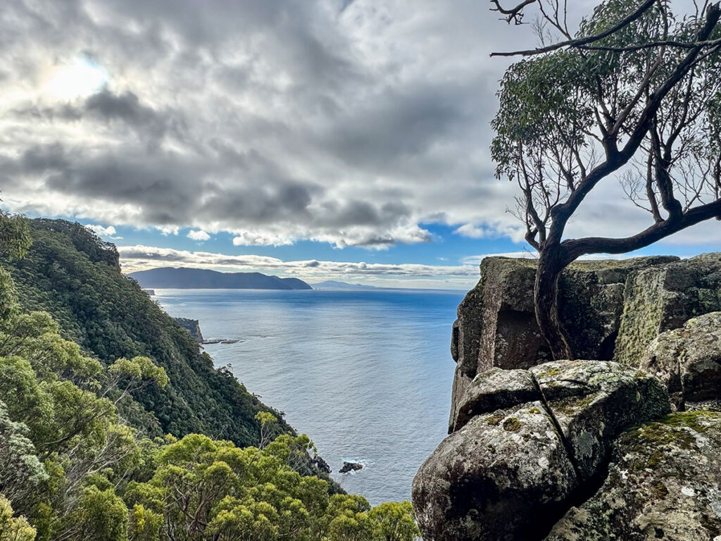
The stage starts on the pristine sands of Fortescue Bay, the course follows the stunning Tasman Coastal Trail, commencing with a few gentle undulations and panoramic views across Fortescue Bay to The Candlestick and Cape Huay, where sheer dolerite columns rise from the sea. Passing Bivouac Bay at the 6km mark, the trail climbs steadily along narrow singletrack, rocky steps, and slippery leaf litter to the High Point at Tatnells Hill at 12km — all while maintaining cliff-top ocean vistas and a sense of pure wilderness solitude.
From the high point, Quoll runners continue along the trail past iconic landmarks including Waterfall Bay, Devil’s Kitchen, and the Tasman Arch. Exiting the track at Doo Town, the course winds around Pirates Bay, finishes along the beach, and concludes above the remarkable Tesselated Pavement at Lufra Apartments Eaglehawk Neck.
Though marginally shorter than the Devil Course, this stage still delivers a full taste of Tasmanian coastal trail running — remote, rugged, and unforgettable.
Day 4 – 15km – Cape Raoul
- Start / Finish location: Cape Raoul Lodge
- Length and elevation gain: 15.1km with 785m ascent
- Terrain type: Smooth going on a very well made, wide gravel path through beautiful coastal bushland – and epic cliff top sections!
- Water points: WP 1 at 13.3km
- Difficulty rating: 5/10
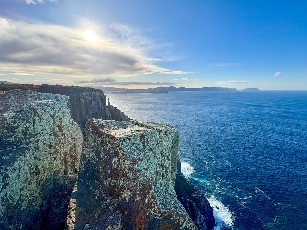
Stage 4 of the Quoll Course takes runners along one of Tasmania’s most scenic coastal tracks. Starting at Cape Raoul Lodge, the course heads along the Cape Raoul Track, climbing steadily through picturesque bushland to the high point at 430m at the 2.7km mark. Turning downhill the smooth, well-formed trails wind along the cliff-top ridge, offering sweeping views of the Southern Ocean and the rugged southern coastline at every step.
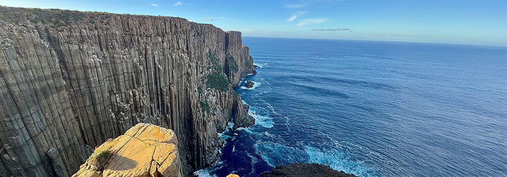
At the 7.5km point Quoll runners reach the dramatic Cape Raoul promontory – a jaw-dropping headland crowned with 300m-high delorite columns that plunge vertically into the inky Southern Ocean far below. It’s a truly otherworldly spot — and to allow you to fully enjoy it, the Cape Raoul lookouts will be in a time-out-zone so you can take in the scenery and snap plenty of photos without impacting your race time.
From here, runners follow the same trail back to the start/finish at Cape Raoul Lodge, with a steady climb to the high point and then downhill to the finish – and a free BBQ and celebration!
Though slightly shorter than the Devil Course, this stage delivers a full taste of Tasmania’s southern coastline — wild, elevated, and unforgettable.
Following the trail
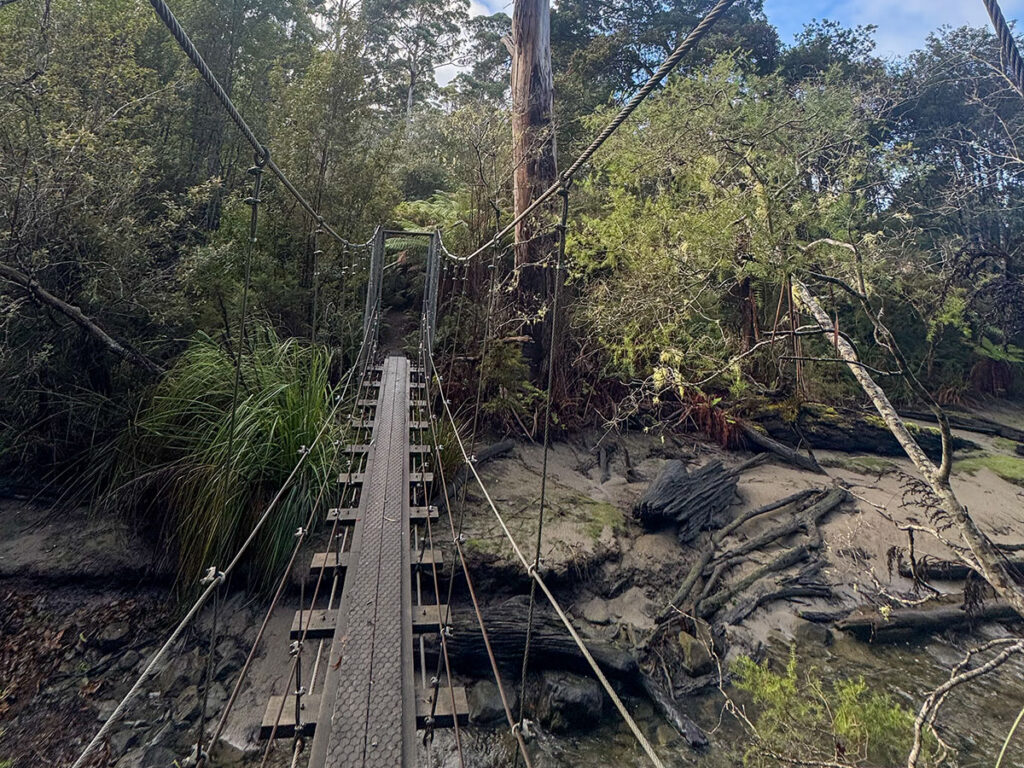
The course will be lightly marked and will require runners to do some level of self navigation by following the GPS route downloaded to their phones or watches whilst racing (GPS route and clear instructions how to use it will be provided). We will mark some key intersections and provide course supervision and support, but competitors will also need to self check if in doubt.
Having said that, day 3 and day 4 are very straight forward and will require minimal self navigation. Day 1 and day 2 are a little more complex but we will assist. This is very similar to how we’ve conducted the Run Larapinta and Run Bibbulmun Stage Races for the last 11 years a no one has had major issues and have found the self navigation aspect quite straight forward.